Development of California Community Wildfire Protection Plans (CWPPs) for the Cloverdale Fire Protection District and City of Healdsburg
Clients
Cloverdale Fire Protection District, Cloverdale, CA
City of Healdsburg, CA
In recent years, California’s fire season has gotten longer, and the state has seen some of the deadliest and most destructive wildfires in recorded history. Numerous agencies, such as the <a href="https://ww2.arb.ca.gov/wildfires-climate-change" target="_blank">California Air Resources Board</a href>, the <a href="https://www.cpuc.ca.gov/industries-and-topics/wildfires" target="_blank">California Public Utilities Commission</a href>, and the <a href="https://public.wmo.int/en/media/news/number-of-wildfires-forecast-rise-50-2100" target="_blank">World Meteorological Organization</a href>, have determined climate change is increasing the frequency and severity of wildfires.
<br>
The Cloverdale California Fire Protection District and the City of Healdsburg, California, each hired Sonoma Technology, in partnership with the <a href="https://www.wildfireservices.biz/auburn" target="_blank">Wildfire Services Group</a href>, to create a Community Wildfire Protection Plan (CWPP). A CWPP, as defined by the 2003 U.S. Healthy Forest Restoration Act, is a community plan that is developed collaboratively, identifies and prioritizes fuel reduction projects, and recommends measures to reduce the ignitability of structures. As noted by California’s Office of the State Fire Marshal, “A local CWPP is one of the most effective ways to influence where and how… agencies implement fuel reduction projects.”
<br>
To help Cloverdale and Healdsburg prepare for and mitigate wildfire events, Sonoma Technology scientists collaborated with fire agencies, county officials, community members, and county, state, and federal land management agencies to create each of the CWPPs. These plans provide science-based assessments of wildfire hazard and threats to homes in Cloverdale’s and Healdsburg’s wildland urban interface (WUI).
<br>
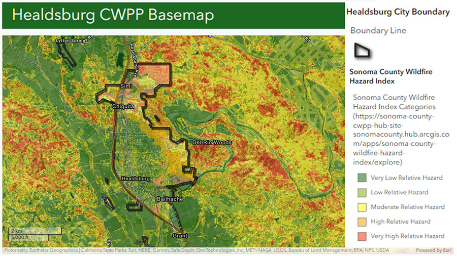
We used fire-behavior modeling and geographic information system (GIS) technology to develop hazard, asset, and risk assessments. Sonoma Technology geospatial experts used high-resolution fuels information and identified areas of significant fire hazard. We also collected and processed a wide array of geospatial data to help develop online interactive community maps. Fire District officials and community stakeholders used our hazard assessment findings and the interactive maps to create action plans for regional fire protection.
<br>
Each CWPP provides fire agencies, land managers, and other stakeholders with clear, actionable tasks to reduce the risk of catastrophic wildfires in the WUI, educate and prepare residents for wildland fires, and protect and enhance economic assets and ecological resources.
<br>
The Cloverdale California Fire Protection District and the City of Healdsburg, California, each hired Sonoma Technology, in partnership with the <a href="https://www.wildfireservices.biz/auburn" target="_blank">Wildfire Services Group</a href>, to create a Community Wildfire Protection Plan (CWPP). A CWPP, as defined by the 2003 U.S. Healthy Forest Restoration Act, is a community plan that is developed collaboratively, identifies and prioritizes fuel reduction projects, and recommends measures to reduce the ignitability of structures. As noted by California’s Office of the State Fire Marshal, “A local CWPP is one of the most effective ways to influence where and how… agencies implement fuel reduction projects.”
<br>
To help Cloverdale and Healdsburg prepare for and mitigate wildfire events, Sonoma Technology scientists collaborated with fire agencies, county officials, community members, and county, state, and federal land management agencies to create each of the CWPPs. These plans provide science-based assessments of wildfire hazard and threats to homes in Cloverdale’s and Healdsburg’s wildland urban interface (WUI).
<br>
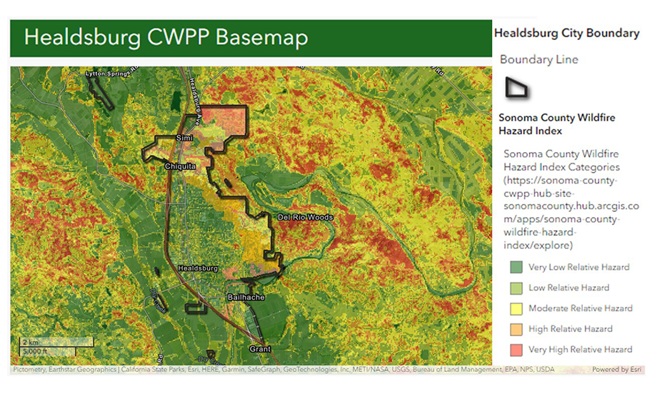
We used fire-behavior modeling and geographic information system (GIS) technology to develop hazard, asset, and risk assessments. Sonoma Technology geospatial experts used high-resolution fuels information and identified areas of significant fire hazard. We also collected and processed a wide array of geospatial data to help develop online interactive community maps. Fire District officials and community stakeholders used our hazard assessment findings and the interactive maps to create action plans for regional fire protection.
<br>
Each CWPP provides fire agencies, land managers, and other stakeholders with clear, actionable tasks to reduce the risk of catastrophic wildfires in the WUI, educate and prepare residents for wildland fires, and protect and enhance economic assets and ecological resources.
Climate
Data Visualization
Fire and Smoke
Modeling
Policy and Planning
Public Outreach


Bryan M. Penfold

Bryan
M.
Penfold
Manager, Data Science Department / GIS Coordinator
bryan@sonomatech.com
/sites/default/files/2025-01/BMPres.pdf
