Climate

Climate

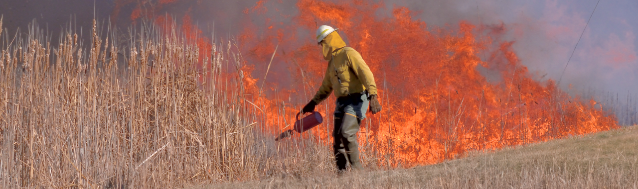
Support your greenhouse gas measurements and modeling, regulatory responses, and mitigation and adaptation efforts.

Sonoma Technology helps clients collect and evaluate data, prepare GHG emissions inventories, forecast impacts, build case studies, and develop tools and decision support systems to address climate change.

Abhilash Vijayan

Submitted by rspencerdev on
Let's discuss your project
Abhilash Vijayan, PhD, PE
Call Abhilash at 707-665-9900
avijayan@sonomatech.com
Abhilash
Vijayan
Director of Transportation, Climate, and Community Air Quality Programs / Senior Scientist

Project and Policy Emissions Modeling

Support greenhouse gas (GHG) emission reduction programs, climate action plan development, and policy implementation with in-depth emissions assessments.

Control Strategy Evaluations

Forecast control program benefits for strategies such as accelerated vehicle fleet electrification. 

Compliance Reporting

Complete analyses required under the National Environmental Policy Act (NEPA) and the California Environmental Quality Act (CEQA).

Greenhouse Gas Emissions Modeling

Model past, current, and forecasted GHG emissions from area, stationary, and natural sources, as well as on- and off-road motor vehicles.

Fire-Related Emissions

Estimate fire-related GHG emissions and gain insights on vegetation management and prescribed fire impacts. 

Emissions Inventory Development

Leverage and reconcile independent data sources to estimate high-quality local, regional, and national fire-related GHG emissions.

Vegetation Management

Enhance forest health, reduce fire risks, and gain GHG emission reduction co-benefits.

Prescribed Fire and Wildfire Analysis Support

Characterize fire-related emissions and impacts on air quality and public health.

Methane and CO<sub>2</sub> Measurements

Identify methane sources, detect leaks, quantify emissions, and support and comply with regulatory controls.

Methane Detection Using Satellite and Ground-Based Monitors

Identify methane emissions using state-of-the-art technologies.

Leak Detection with “Next Generation” Sensors

Deploy advanced methane measurement equipment to identify and address methane releases. 

Regulatory Support

Use robust fenceline measurements to comply with oil and gas industry reporting requirements.

Black Carbon, Aerosol, and Meteorological Measurements

Use real-world field measurements to identify sources, quantify emissions, and forecast air quality and climate impacts.

Climate-Driven Wildfire and Weather Forecasting

Improve meteorological measurements and forecasting to anticipate and respond to wildfire risks.

Aerosol Effects

Understand how particles affect Earth’s climate system, including snowpack and albedo changes from black carbon and dust.

Black Carbon and PM Measurements Near Major Sources

Estimate source impacts on air quality and climate-forcing pollutant emissions.

Wildland Fire and Smoke Impacts

Use advanced data and decision support tools to predict and mitigate wildland fire and smoke impacts.

Prescribed Fire Planning

Optimize planned burns to reduce smoke impacts, protect at-risk populations, and support timely public outreach. 

Fire Impact Forecasting

Model climate-driven fire and smoke air quality impacts.

Mapping and GIS Support

Visualize high-risk areas. Prioritize and focus adaptation efforts using state-of-the-science spatial datasets and analysis techniques.

Mitigation

Leverage traditional air quality controls to mitigate climate-driven health impacts and achieve co-benefits.

Co-Benefit Evaluation

Use federally approved emissions and air quality models to evaluate public health co-benefits from GHG control programs.

Develop Software and Decision Support Systems

Optimize your fire and fuels data use with a customized software solution. Sonoma Technology develops, manages, and customizes software tools and decision support systems to meet each project’s scientific goals.

Equity Improvement

Advance environmental justice by modeling community-scale emissions and air quality.

Adaptation

Protect your communities from wildfires and other climate-driven risks.

Community Wildfire Protection Planning

Collaborate with fire agencies, county officials, community members, and county, state, and federal land management agencies to create Community Wildfire Protection Plans (CWPPs).

Fire Modeling

Plan for and mitigate wildfire impacts using high-resolution vegetation maps to characterize fuels and improve hazard assessment planning.

Evacuation Planning

Assess current conditions for wildfires, traffic flow, and public communication practices, and reduce risks to improve evacuation outcomes.

Products

Use phone app, data visualization, and decision support tools to understand real-time air quality and smoke conditions.

Community Air Quality

Make informed decisions to protect public health with accurate, hourly, community-scale information about current and forecasted air quality. 

Real-Time Smoke Conditions

Display fire, smoke, and air quality data for places important to you. 

Situational Awareness

Use our visualization tools to see plume trajectories and identify potential emissions sources. 

Submitted by SonomaTechnology on